The manual mode of obtaining title to land has especially exacerbated the documentary setbacks associated with land ownership in Nigeria. While Section 5 of the Land Use Act (1978) empowers the Governor of a State to grant statutory rights of occupancy to any person for all purposes, and Section 2 of the Lagos State Land Registration Law (2015) also provides that “every document of interest or title to land shall be registered in accordance with the provisions of this law,” many property owners in various states across Nigeria often have to wait for up to six years to get their Certificate-Of-Occupancy (C of O) and other relevant land titles in the process of registering their land at the respective state land registries.
The high costs of obtaining title to land alongside time-consuming land documentation procedures due to hand-operated systems continue to hinder the smooth administration of Nigeria’s land tenure system through a scarcity of resourceful land data and a lack of other related developments; the Nigeria Bureau of Statistics (NBS) has confirmed that more than 71.4 percent of landlords in Nigeria are without relevant land titles.
Using Technology To Ensure Access To Land Registration And Documentation
The use of cadastral remote sensing technology, blockchain technology, and electronic land registration systems can significantly facilitate efficiency, accessibility, and transparency in Nigeria’s land registration process. Lagos’ newly launched ‘Aumentum’ automation process can also be adopted nationally to facilitate the registration of property translations in a more chronological, controlled, and transparent manner.
We shall examine the role that these technologies can play in thawing out frozen land processes across Nigeria:
- Using cadastral remote sensing technology to survey land.
State governments in Nigeria can use cadastral survey information for effective land administration through enhanced spatial information on the legal boundaries of properties within their jurisdictions.
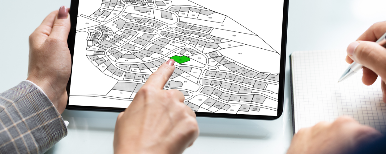
A cadastral map is a map that provides accurate information about the real estate property within a specific area. Through cadastral mapping, crucial land details such as district names, certificates of title numbers, positions of existing structures, section numbers, adjoining street names, selected boundary dimensions, and references to prior maps can be geographically identified.
Cadastral survey information can help to concisely implement ownership rights, prevent land encroachments, verify titles to land, support land registration, aid in land valuation and taxation, and provide a legal framework for dispute resolution, amongst many other useful land documentation needs.
- Employing Blockchain Technology In Land Registration
Digitization of land registration through blockchain technology is fast becoming one of the most reliable and secure ways of administering land and landed property. A blockchain is a distributed ledger that duplicates and distributes transactions across a network of computers participating in it, making it difficult for information recorded on the system to be changed, hacked, or manipulated. Through blockchain technology, land data in Nigeria at the land registries can be properly stored, preserved, and employed for maximal land administration.
In 2016, the Republic of Georgia was the first national government to use blockchain technology to store records of official land transactions. Since then, the governments of Dubai, Brazil, Honduras, India, Japan, Russia, Sweden, the United Kingdom, and the United States of America have all employed blockchain technology for a more secure and transparent land registration system.
- National Adoption of the Lagos State ‘Aumentum’ Land Process
In November 2023, the Lagos State Lands Bureau launched its ‘Aumentum’ solution as a digitized process that allows the Lagos State government to automate land record management and facilitate the registration of property transactions in a more “chronological, controlled, and transparent manner”. The Aumentum Land Administration solution was designed to customize and streamline land workflow processes in Nigeria through higher productivity, enhanced revenue generation, security of documents, and smarter customer delivery.
Over the years, Lagos State has also engineered the Electronic Document Management System (EDMS) in 2013, the Electronic Certificate of Occupancy in 2014, and the Integrated Land Administration Automation System in 2019 for efficient and cost-effective land administration.
Sub-national governments in Nigeria are thereby advised to borrow a leaf from Lagos’ wide range of digitized solutions to land registration and administration so that land processes across Nigeria can be fully sped up.
Bottom Line
A clear, reliable, and transparent land title registration process plays an indubitable role in promoting national economic development. A sustainable process for land title documentation encourages direct investment through a well-harnessed real estate market. Governments in Nigeria at the state and federal levels must wake up to the opportunities of a thriving property sector through a smarter range of digitized land title registration procedures.
Doyin Olagunju is a legal practitioner. He is a fellow of the Ominira Initiative for Economic Advancement.


